In the two protected marine areas of Carry-le-Rouet and La Couronne, the following are prohibited: Mooring of boats Scuba diving Fishing in all its forms (professional fishing, angling, spearfishing and seafood collection). Sworn guards provide annual surveillance on the two reserves (see the leaflet on reserve regulations).
Presentation
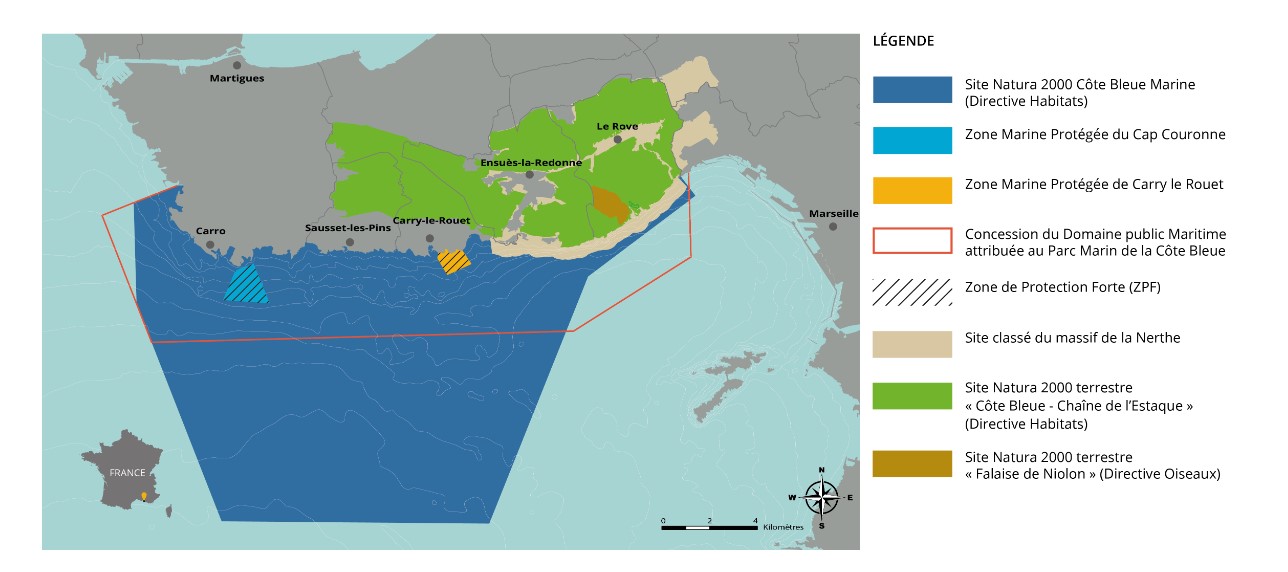
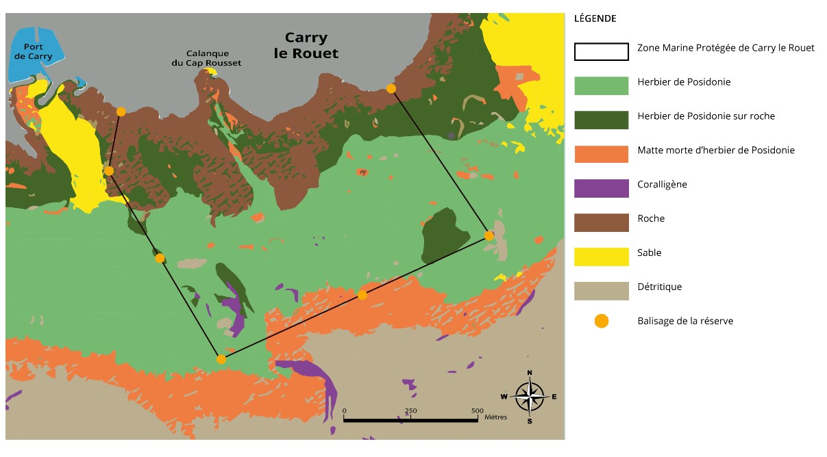
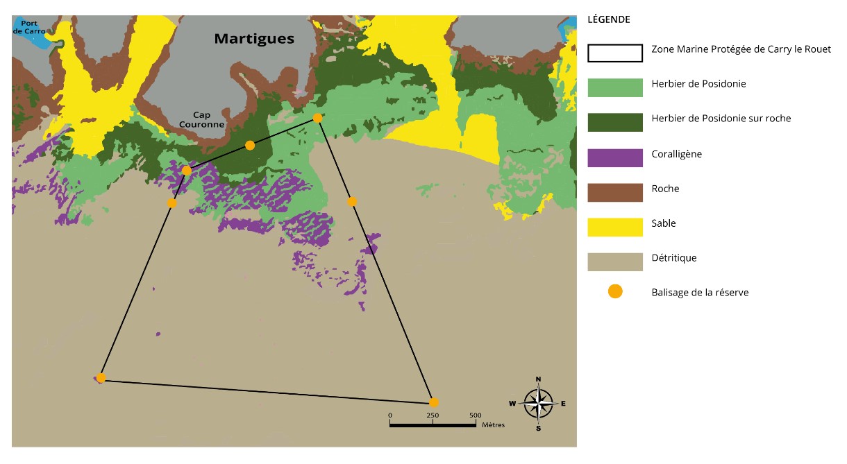
The marine protected area in front of Carry-le-Rouet was created in December 1982. It is an 85 ha area which borders the coastline between the port of Carry and Anse du Rouet, and which extends as far as '1 km offshore, near the deep limit of the Posidonia meadows, at a depth of 30 m. The rocky bottoms are present along the coastline and extend offshore in the form of slabs and blocks emerging from the seagrass, the largest being between 10 and 15 meters deep. The area is delimited by 6 permanent buoys and 2 spars marking the limits on land.
Following developments in the environment linked to the management and protection of the Carry-le-Rouet reserve, the representatives of the professional fishermen of Martigues wanted the realization of a project to develop the funds in front of the Cape sector -Crown. This project took shape in 1996, with the creation of one of the largest fully protected marine areas in the Mediterranean at the time (210 ha). This area begins approximately 50 meters from the coast, between Cap-Couronne and Pointe Noire. It extends offshore about 1 mile to depths of 50 meters. The bottoms are made up of sand, coralligenous rocks, and Posidonia meadows. The reserve is delimited by 7 permanent buoys.